A Weather Podcast for Everyone
Subscribe now:
The Weather Whys Podcast is for anyone, whether you’re a weather newbie or a “weather weenie.” Hosted by Ed Oswald, this podcast is a production of Cirrusly Weather. Among the topics we’ll cover are weather, climate, and sustainability. After listening to each episode, you’ll have a basic understanding of the topic and its importance. This podcast has no hype, just the facts, all within ten minutes or less.
Our Current Favorites
Listen Now:

-

Episode 13: Season 3 Trailer
Sep 25, 2025 • 2:38
We’re going to video! If you’d like to watch this episode, you can see it right here on YouTube. All future episodes will be posted first there! Season 3 has started! We also have a new email address: podcast@cirruslyweather.com. New episodes are coming sooner than you think (we’re about to…
-
Episode 12: Weather Data Should Be Free
Mar 14, 2025 • 5:22
In this urgent episode of the Weather Whys Podcast, we discuss NWS privatization and the critical understaffing of National Weather Service offices due to recent cuts influenced by Elon Musk and the Department of Government Efficiency. The episode explores the history and growth of private sector meteorology, including AccuWeather’s controversial…
-

Episode 11: YouTube Meteorologists – Can You Trust Them?
Jan 24, 2025 • 3:50
In this episode of the Weather Whys Podcast, host Ed Oswald dives into the world of YouTube meteorologists. YouTube has allowed passionate weather enthusiasts to share their expertise with a broad audience. Learn about traditional meteorologists’ job challenges and how some turn to YouTube to make a name for themselves.…
-

Episode 10: The Polar Vortex – Bitter Cold May Be Unleashed
Jan 19, 2025 • 3:52
In this episode of the Weather Whys Podcast, host Ed Oswald explains the intricacies and impacts of the polar vortex, a term that has become part of everyday winter vocabulary. The episode delves into the polar vortex, its functions, and the phenomena of sudden stratospheric warming events that can disrupt…
-

Episode 9: Project Stormfury: We Failed to Stop Hurricanes
Nov 11, 2024 • 6:32
And we’re back for our second season! In this episode of the Weather Whys Podcast, host Ed Oswald delves into the fascinating history of Project Stormfury, the U.S. Government’s ambitious attempt to weaken hurricanes through cloud seeding in the 1960s and 70s. Ed explores this endeavor’s origins, experiments, and eventual…
-
Episode 8: Weather vs Climate – A Helpful Guide
Jun 28, 2024 • 5:03
In this episode of The Weather Whys Podcast, we explain the often misunderstood differences between weather vs climate. Weather refers to short-term atmospheric conditions that change frequently, while climate represents long-term patterns over decades or centuries. Ed highlights how weather impacts daily life, how climate influences long-term planning, and global…
-
Episode 7: Changes in Earth’s Orbit Transform Climate
Jun 21, 2024 • 5:47
In this episode of the Weather Whys Podcast, host Ed Oswald delves into Milankovitch cycles—changes in Earth’s orbit and rotation that drive long-term climate change. Learn about the Earth’s axial progression, obliquity, and eccentricity, and discover how these cycles impact seasonal contrasts, global warming, and historical climate events. Explore the…
-

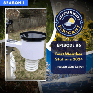
Episode 6: Best Weather Stations of 2024
Jun 14, 2024 • 5:00
In this episode of the Weather Whys Podcast, we talk about home weather stations! Host Ed Oswald from The Weather Station Experts reviews the best weather stations for 2024. The best weather stations include the budget-friendly Ambient Weather WS-1965, the durable Davis Vantage Vue, the versatile Ambient Weather WS-5000, the…
-
Episode 5: Tornado Alley is Shifting East. Here’s Why That Matters.
Jun 7, 2024 • 4:11
Is Tornado Alley shifting east? In this episode of Weather Whys, we delve into the shifting patterns of tornado activity in the United States. We thought this episode would be especially relevant with the traditional peak of tornado season upon us. Tornado Alley has traditionally meant the Great Plains, but…
-
Episode 4: Hurricane Season is Longer Than You Think
May 31, 2024 • 4:53
If you live near the East Coast, hurricanes are a fact of life during the summer and early fall for most. In this episode of Weather Whys, host Ed Oswald looks at the Atlantic hurricane season in detail. Where hurricanes are most likely to form shifts throughout the season, leading…
Episodes and Show Notes
Episode 13: Season 3 Trailer
We’re going to video! If you’d like to watch this episode, you can see it right here on YouTube. All future episodes will be posted first there! Season 3 has started! We also have a new email address: podcast@cirruslyweather.com. New episodes are coming sooner than you think (we’re about to record the first!) In this … Read more
Episode 12: Weather Data Should Be Free
In this urgent episode of the Weather Whys Podcast, we discuss NWS privatization and the critical understaffing of National Weather Service offices due to recent cuts influenced by Elon Musk and the Department of Government Efficiency. The episode explores the history and growth of private sector meteorology, including AccuWeather’s controversial role in monopolizing weather data, … Read more
Episode 11: YouTube Meteorologists – Can You Trust Them?
In this episode of the Weather Whys Podcast, host Ed Oswald dives into the world of YouTube meteorologists. YouTube has allowed passionate weather enthusiasts to share their expertise with a broad audience. Learn about traditional meteorologists’ job challenges and how some turn to YouTube to make a name for themselves. However, it’s vital to avoid … Read more
Episode 10: The Polar Vortex – Bitter Cold May Be Unleashed
In this episode of the Weather Whys Podcast, host Ed Oswald explains the intricacies and impacts of the polar vortex, a term that has become part of everyday winter vocabulary. The episode delves into the polar vortex, its functions, and the phenomena of sudden stratospheric warming events that can disrupt it. Oswald distinguishes between minor … Read more
Episode 9: Project Stormfury: We Failed to Stop Hurricanes
And we’re back for our second season! In this episode of the Weather Whys Podcast, host Ed Oswald delves into the fascinating history of Project Stormfury, the U.S. Government’s ambitious attempt to weaken hurricanes through cloud seeding in the 1960s and 70s. Ed explores this endeavor’s origins, experiments, and eventual downfall, shedding light on the … Read more
Episode 8: Weather vs Climate – A Helpful Guide
In this episode of The Weather Whys Podcast, we explain the often misunderstood differences between weather vs climate. Weather refers to short-term atmospheric conditions that change frequently, while climate represents long-term patterns over decades or centuries. Ed highlights how weather impacts daily life, how climate influences long-term planning, and global issues like climate change. To … Read more
Episode 7: Changes in Earth’s Orbit Transform Climate
In this episode of the Weather Whys Podcast, host Ed Oswald delves into Milankovitch cycles—changes in Earth’s orbit and rotation that drive long-term climate change. Learn about the Earth’s axial progression, obliquity, and eccentricity, and discover how these cycles impact seasonal contrasts, global warming, and historical climate events. Explore the intriguing hypothesis linking these cycles … Read more
Episode 6: Best Weather Stations of 2024
In this episode of the Weather Whys Podcast, we talk about home weather stations! Host Ed Oswald from The Weather Station Experts reviews the best weather stations for 2024. The best weather stations include the budget-friendly Ambient Weather WS-1965, the durable Davis Vantage Vue, the versatile Ambient Weather WS-5000, the high-tech Tempest Weather System, and … Read more
Episode 5: Tornado Alley is Shifting East. Here’s Why That Matters.
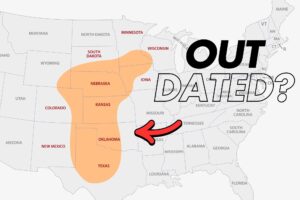
Is Tornado Alley shifting east? In this episode of Weather Whys, we delve into the shifting patterns of tornado activity in the United States. We thought this episode would be especially relevant with the traditional peak of tornado season upon us. Tornado Alley has traditionally meant the Great Plains, but tornadoes are becoming more frequent … Read more
Episode 4: Hurricane Season is Longer Than You Think
If you live near the East Coast, hurricanes are a fact of life during the summer and early fall for most. In this episode of Weather Whys, host Ed Oswald looks at the Atlantic hurricane season in detail. Where hurricanes are most likely to form shifts throughout the season, leading up to a dramatic peak … Read more
Episode 3: Auroral Musings – Our First Sighting! Wow!
Well, you don’t always need a script to do a podcast as we’ve found out in this episode of the Weather Whys Podcast! Your host Ed Oswald shares a personal story about witnessing the Northern Lights after a series of powerful solar storms on May 11th. The storms caused the most stunning aurora display in … Read more
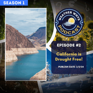
Episode 2: California is Drought Free. But For How Long?
As the West Coast reels from a historic megadrought, California faces a pivotal question: Is the dry spell finally over? In this riveting episode of the Weather Whys Podcast, join host Ed Oswald as we delve into the recent meteorological phenomena that have soaked the Golden State. Unpack the science behind atmospheric rivers, the lifeblood … Read more
Episode 1: 2023 Was Crazy Weatherwise. 2024 Will Start the Same.
Join us on the first episode of the Weather Whys Podcast, where host Ed Oswald from The Weather Station Experts takes us through a riveting review of 2023’s extreme weather events. From record-breaking rainfall to scorching heatwaves, wildfires to flash droughts, and historic hurricanes, we delve into the forces behind these phenomena, including the impact … Read more
Episode 0: Weather Whys Podcast – Hello World!
Welcome to the inaugural episode of Weather Whys, where curiosity meets meteorology! Join host Ed Oswald from The Weather Station Experts as he introduces a podcast dedicated to unraveling the mysteries of weather and climate. Discover what makes Weather Whys a unique addition to your audio library, with its commitment to education, factual science, and … Read more
