Weather Whys Podcast Episode 2: California is Drought Free. But For How Long?

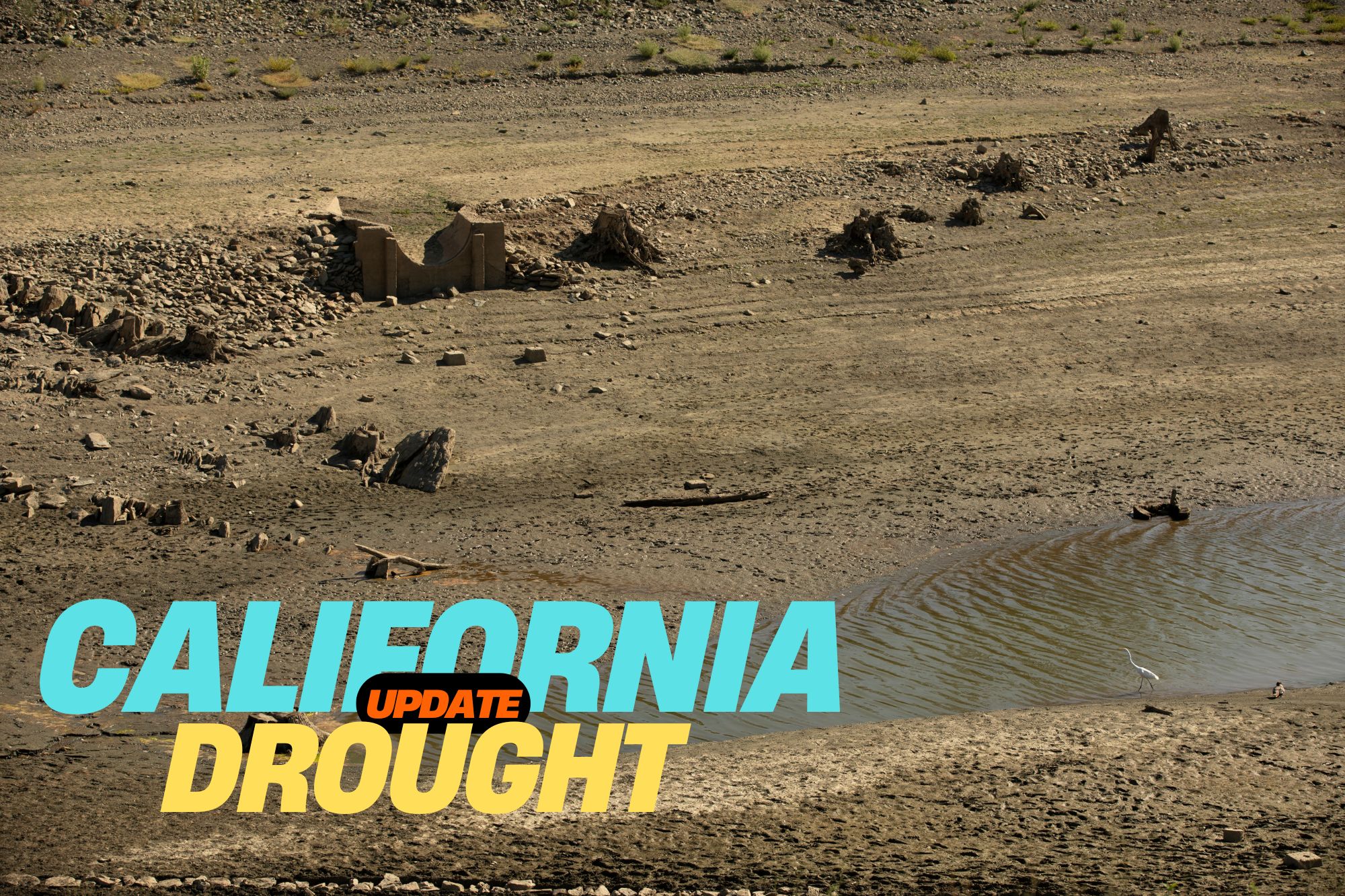
Lake Mead during peak of California's most recent drought
The Weather Whys Podcast
Weather Whys Podcast Episode 2: California is Drought Free. But For How Long?
Loading
/

As the West Coast reels from a historic megadrought, California faces a pivotal question: Is the dry spell finally over? In this riveting episode of the Weather Whys Podcast, join host Ed Oswald as we delve into the recent meteorological phenomena that have soaked the Golden State.

Unpack the science behind atmospheric rivers, the lifeblood of California’s water supply, and understand their role in the dramatic resurgence of reservoirs like Lake Oroville. Discover how a tropical twist and heavy Sierra Nevada snows have contributed to the state’s water revival.

But has the deluge been enough to turn the tide on two decades of drought? We’ll explore the complexities of groundwater mismanagement and the precarious balance between replenishment and depletion. With the potential for another wet winter on the horizon, thanks to El Niño, California’s weather fortunes may be changing – but the long-term battle against drought and climate change continues.

[00:00:04] Welcome to the Weather Whys podcast. I’m your host Ed Oswald from the Weather Station Experts. In this episode, we’re discussing California’s mega drought. Is it over? I’m glad you could join us. Let’s get started.

[00:00:20] The sound of rain. Most Americans take this for granted, but rain is a valuable commodity for those living in the West. And more often than not, there’s too little of it to go around. That was the case across California over the past two decades. Say for a brief respite here and there, rainfall has averaged well below normal.

[00:00:39] This lack of rain Reservoir levels fell to the lowest recorded levels in 2023, and it seemed as if California and the rest of the West were heading for a serious water crisis. And then the rains came. Starting in late December, a series of strong storms pummeled California. Places that only see a few inches of rain in an entire year got that in a single storm.

[00:01:01] And it wasn’t just one, over a dozen storm systems struck the state between December and March. These storms found their way to California along an atmospheric river. Atmospheric rivers are narrow bands of wind that transport a lot of water vapor from the tropics to more temperate climates. They can be several thousand miles long and only tens to hundreds of miles wide.

[00:01:22] Most of you will know these events by their nickname, the Pineapple Express. The name comes from where it originates, near Hawaii. Reservoirs that have been critically low rose quickly. Perhaps the most significant change was Lake Oroville in Northern California. In September 2021, water levels dropped to 628 feet, their lowest level ever.

[00:01:41] By June of the following year, though, the lake was at 100 percent capacity, rising some 300 feet over that period. Historic snows in the Sierra Nevada were an added benefit. After years of little snowfall, some areas saw 200 300 percent of their normal snowfall, continuing into March and April in some places.

[00:02:01] And for the first time in years, a snowpack made it through the hot California summer, critical to keeping water flowing during those dry summer months. Then who would’ve expected a tropical system to strike Southern California? That was an added bonus and helped alleviate the long-term drought the state had been experiencing.

[00:02:18] So after all this, can we say that California’s mega drought is over? We’ll discuss that more after the break.

[00:02:26] The Weather Whys Podcast is brought to you by the Weather Station Experts. Home Weather station is a great way to expand your weather knowledge and the weather station experts has real hands-on reviews so you can make the right choice.

[00:02:37] Visit us on the web at theweatherstationexperts.com. Welcome back. Even with all the rain that California has been seeing, is the state truly in the clear? Let’s take a look at the bigger picture. First, ground water mismanagement has left some underground aquifers so dry that they’ve collapsed from the weight of the ground above them.

[00:02:58] In some areas of California, the ground is actually sinking because of this. Even in winter, as extreme as this past one, is not enough to replenish these aquifers. That will take multiple seasons. In other words, if the state swings back to dry conditions again, the megadrought will come roaring back. But a few things are working in the state’s favor.

[00:03:18] We’ve already mentioned Hillary. That storm gave unexpected replenishment to reservoirs across SoCal at a time when little, if any, rainfall typically falls. And while early on storms have targeted the northwest, another area experiencing extended drought. It appears at least a normal if not another wet winter is in store thanks to the effects of El Niño, according to meteorologists.

[00:03:40] That’s very good news. But we must keep in perspective the historic nature of this megadrought. Prior to last winter, climate experts found that the drought was more severe and long lasting than any other in the past 600 years. Then there’s the groundwater mismatchment. The ground can’t hold as much water as it used to due to the loss of those aquifers.

[00:04:00] Even if these were to refill completely, California would still have less water overall stored for the inevitable dry weather the states always experienced. Combined with the effects of climate change, the normal swings of California’s climate have become much more pronounced. While we’re apparently in a period of higher precipitation, it would have to continue past this winter to truly make a difference.

[00:04:21] So while California might be out of drought now by definition, the threat of it will always be around. But at least we’ve stepped back from the ledge, and Californians won’t be forced to make tough decisions. At least for the near future.

[00:04:42] You have just listened to the Weather Whys podcast. I’m your host, Ed Oswald.

[00:04:48] Weather Whys is a production of the Weather Station Experts and OzMedia. Today’s episode was produced by Derek Oswald and myself from our studios here in West Lawn, Pennsylvania. If you’d like to learn more about Weather Whys, please visit our website at weatherwhys.show. On our website, you can listen to this episode and any past episodes and also get in touch.

[00:05:10] We’d love to hear from you. Don’t forget to subscribe to Weather Whys to get the latest episodes as soon as we release them. You can find those links to Apple Podcasts, Spotify, Google, and more on our website as well. That’s all for today. Be sure to join us again next time when we take a look at winter’s hidden danger, the snowstorm.

[00:05:27] Thanks for listening, and stay weatherwise.

Key points

0:21 – California’s drought was setting records
1:01 – Over a dozen storm systems struck California between December and March
2:43 – Is the California megadrought really over?
3:42 – Keeping the historic nature of the megadrought in perspective

Show Notes

California’s drought was historic:

Called the Pineapple Express: “because moisture builds up in the tropical Pacific around Hawaii and can wallop the U.S. and Canada’s West Coasts with heavy rainfall and snow.”

Historic snows in the Sierra Nevada. Check out the difference in these satellite images!

California’s water problems – see this NYT article

Weather Whys Podcast Episode 1: 2023 Was Crazy Weatherwise. 2024 Will Start the Same.

The Weather Whys Podcast
Weather Whys Podcast Episode 1: 2023 Was Crazy Weatherwise. 2024 Will Start the Same.
Loading
/

Join us on the first episode of the Weather Whys Podcast, where host Ed Oswald from The Weather Station experts, takes us through a riveting review of 2023’s extreme weather events. From record-breaking rainfall to scorching heatwaves, wildfires to flash droughts, and historic hurricanes, we delve into the forces behind these phenomena, including the impact of El Niño and climate change. Tune in for a forecast of what’s to come in 2024 and learn why understanding weather patterns is more crucial than ever.

[00:00:00] Ed Oswald: Welcome to the Weather Whys Podcast, I’m your host Ed Oswald from The Weather Station Experts. In this episode, we’ll take a look at this year’s crazy weather and why 2024 will start just as crazy. I’m glad you could join us, let’s get started.

[00:00:21] Again, thanks so much for joining us. This is The Weather Whys Podcast Episode 1, our first “official” episode. With the end of the year coinciding with the first episode of our podcast, we thought it logical to start out with a year in review. And what a year it was weatherwise. If you were out west, you’ll remember this sound from last winter:

[00:00:42] Rain, and lots of it, fell across much of the Southwest to start the year, even New York city by years end had its most rainfall in a day ever.

[00:00:52] But much of the year it felt like the world was on fire, with record breaking heat.

[00:00:56] Researchers believe the three warmest days in the past 150,000 years happened this summer, spurring a wildfire season that was unprecedented in the number of Americans it affected. While California’s rainy winter kept their fire season to a minimum, unusually dry weather across Hawaii and Eastern Canada spurred massive wildfires.

[00:01:15] Thick wildfire smoke choked off major Eastern us cities affecting millions, but this list is just a small part of what happened. Worldwide, 2023 will be the hottest year ever.

[00:01:26] So what drove all this craziness? El Niño. For years, we have been dealing with La Niña, which are cooler than normal waters in the equatorial Pacific ocean. While La Niña brings her own set of wild weather, it’s far less severe, and far less widespread.

[00:01:41] El Niño is the opposite, where the equatorial Pacific waters are warmer than normal. The 2023 event is what’s called a “super El Niño,” meaning water temperatures are much warmer. . And although we’re drastically simplifying it, warmer waters make it easier for water to evaporate, which in turn puts more water vapor in the air. This is partially the reason for many of the extreme rainfall events we’ve seen worldwide.

[00:02:03] On the flip side, this excess rain must be balanced out with excess dryness elsewhere. El Niños are infamous for widespread heat and drought as well. And then on top of this, there’s climate change. The world has already warmed at nearly a degree Celsius since the 1960s. The 2023 El Niño added a half degree on top of that.

[00:02:22] The result was a preview of a world where 1.5 degrees of warming isn’t a record, but a daily reality. while this El Niño event may be peaking, weather patterns will continue to be affected.

[00:02:33] As winter arrives in the Northern Hemisphere, summer begins in the south. This El Niño event didn’t start until April, so the Southern Hemisphere has yet to have its El Niño summer.

[00:02:43] Summer will coincide with peak strength, so the effects will likely be significant. Australia experiences extreme heat and drought during El Niños, often accompanied by significant wildfires, but we’ll save that for a future episode. So what were the five biggest weather events of this crazy year? We’ll have more about that after the break.

[00:03:02] The Weather Whys Podcast is brought to you by The Weather Station Experts. A home weather station is a great way to expand your weather knowledge, and The Weather Station Experts has real hands-on reviews so you can make the right choice. Visit us on the web at theweatherstationexperts.com.

[00:03:18] Thanks for staying with us. As I said before the break, we’re counting down the biggest weather stories of the year.

[00:03:25] Starting out in January, the atmospheric river events in California certainly belong on our list. I’m not going to spend too much time on this as its subject of our next episode, but California’s years long drought ended in spectacular fashion.

[00:03:37] This certainly was the big news story for the beginning of 2023. Although it started in December, as late as March portions of California were still dealing with heavy rains and snows.

[00:03:47] But while rainy weather is normal in California during the winter, elsewhere winter was anything but. Some Northeast cities saw little of any measurable snowfall, with temperatures averaging well above normal. In fact, Philadelphia went an entire winter without more than one inch of snow in a single snow storm, a streak that now has lasted nearly two years.

[00:04:06] Here at our weather station, the average winter high was 47 degrees. While that might seem cold to some of you, it’s well above normal here by about five degrees or so.

[00:04:15] The weather did calm down a bit during the spring. However, things began to dry out and we began watching a flash drought spread across the Northeast and Eastern Canada. Flash droughts occur when weather patterns get “stuck,” causing an area to receive an extended period of little rainfall.

[00:04:31] That was the case here. We received just .22″ of rain in May and a little over an inch in June, continuing a dry start to the year partially due to the rainy weather out west.

[00:04:41] This set the stage for a memorable event in June for much of the Northeast. The same dry conditions in the Northeast were occurring in Eastern Canada as well, but much more severe. By late spring, tens of thousands of acres of Canadian forest were burning out of control.

[00:04:55] An unusually strong cold front swept across the Northeast in the first part of the month. Instead of just cool, dry air. These Northeast winds also brought the smoke behind it so thick that it rolled in like fog.

[00:05:06] Smoke filled the air in New York City, and skyscrapers disappeared into the thick haze. Here in Pennsylvania, it wasn’t much better: for two days straight smoke was in the air thick enough that you could even see it inside the house.

[00:05:18] But the summer had more in store. By July, sea surface temperatures in the Florida keys rose above 100 degrees for the first time in recorded history after weeks of relentless heat and little rain, and this is at a time when afternoon thunderstorms are typically a daily occurrence.

[00:05:32] These warm waters made rapidly intensifying tropical cyclones a constant risk, some in places you wouldn’t expect.

[00:05:38] Even in the Eastern Pacific water temperatures were running much above normal, and that set the stage for a tropical storm in Southern California of all places in August.

[00:05:47] Listeners on the West Coast know that rain is a rarity during the summer months, much less a land falling tropical system. While Hillary weakened to a tropical storm before making landfall, its effects were extreme.

[00:05:58] For the first time ever, the Southern California coast was placed under a tropical storm warning. One to three inches of rain fell across much as sound on California, with as much as the foot in the mountains. Death valley received an entire year’s worth of rainfall in just a single day.

[00:06:13] While rain in the summer is rarity and arguably a blessing for a state where water comes at a premium, it was too much at once. Flooding was widespread, and damage was extensive.

[00:06:23] But the Pacific ocean wasn’t done yet. October’s hurricane Otis was memorable for its rapid strengthening, which even surprised meteorologists.

[00:06:31] For much of the time after it formed on October 15th through the 22nd, Otis wasn’t even named, or even a tropical depression . In fact, several times it looked like the storm would dissipate altogether. But late on the 22nd, it finally gained tropical storm status, and its name Otis, starting a historic intensification phase.

[00:06:48] At the same time, wind currents were directing Otis northwestward towards the Mexican coast. By the afternoon of the 23rd, it was already a major category three hurricane with winds of 125 miles an hour. Otis continued to strengthen through the 25th when it reached category five status with winds of 165 miles an hour. It maintained this strength through landfall in the resort city of Acapulco.

[00:07:13] Otis is the first Pacific category five hurricane to make landfall, and by far the costliest: damage was estimated at $16 billion, predominantly in and around Acapulco. Then there’s the strengthening: 115 miles per hour in 24 hours made it the second fastest strengthening hurricane in recorded history, and that’s anywhere on the planet.

[00:07:33] There’s many more, but we’re running out of time for this episode. We’d like to hear from you. If you agree or have other events to share, email us at [email protected]. We might share your feedback in a future episode.

[00:07:49] You have just listened to the Weather Whys Podcast. I’m your host, Ed Oswald. Weather Whys is a production of The Weather Station Experts and Oz Media. Today’s episode was produced by Derek Oswald and myself from our studios here in West Lawn, Pennsylvania.

[00:08:03] If you’d like to learn more about Weather Whys visit Weather Whys that’s W-H-Y- S.show. On our website, you can listen to this episode at any past episodes and get in touch. We’d love to hear from you.

[00:08:15] Don’t forget to subscribe to Weather Whys to get the latest episodes. As soon as we release them, you can find those links to Apple Podcasts, Spotify, Google, and more on our website as well.

[00:08:25] That’s all for today. Be sure to join us again next time, when we take a look at California’s megadrought. Thank you for listening.

Key Points

0:39 – A quick summary of the year in weather
1:26 – El Niño is to blame
3:25 – Our picks for the biggest weather stories of 2023

Show Notes

New York City tops world’s worst air pollution list from Canada wildfire smoke – CNBC June 7, 2023

Canadian wildfires: what we saw here in eastern Pennsylvania!

What will winter bring to Sacramento after a year of heavy rain and snow in California?Sacramento Bee, October 2, 2023

Not one, but two memorable Eastern Pacific tropical systems, Hillary (southern California, during dry season!) and Otis (Acalpulco)

What do you think? Let us know!